
Binn Ui Ruairc [Beenarourke]
Good walks are even better shared.
Overview
Exploring Binn Ui Ruairc [Beenarourke]
Nestled in the scenic Caha Mountains of County Kerry, Binn Ui Ruairc, or Beenarourke, rises to an elevation of 644 metres. Not only a Marilyn but also a bastion of green hills and breathtaking views, this mountain is a must-visit for outdoor enthusiasts seeking a bit of adventure mixed with stunning vistas.
Geology
The geological makeup of Beenarourke is primarily sandstone and shale, which results in its natural beauty and biodiversity. The area's rocks whisper tales of ancient times and the changing landscape. Hiking here not only offers exercise, but it builds a connection with Earth's history.
Routes
The popular Caherdaniel to Binn Ui Ruairc route spans approximately 7.5 km, taking around three hours to complete. It’s a moderate trek that provides opportunities to encounter local flora and fauna while appreciating the panoramic ambiance. The well-trodden path leads you uphill through thriving fields, ensuring that every turn brings fresh views and the occasional surprise. Just don’t forget your camera!
Summit Features
At the peak, you’ll find a quaint stone cairn, standing proudly along with a trig point – perfect for a summit selfie! These residual structures tell the tale of many adventurers who made it to this remarkable height. After all, if a mountain has a selfie spot, is it even a mountain?
Terrain Type
The terrain varies from rocky outcrops to grassy hills, with a fair share of boggy patches that could test your balance - perfect for honing your ninja skills!
Views
Looking out from the summit, the sweeping landscapes of the Caha Mountains greet your eyes, with Kenmare Bay shimmering in the distance and the stunning peaks of the Ring of Kerry vying for your attention on clear days. Avoid the summer haze for the best views; spring and autumn prove to be the golden times.
Hazards
Be wise when navigating these trails, especially in wet weather - the path can become slippery and some areas can surprise you with their boggy texture. Always be prepared with a plan B—especially when Mother Nature likes to change her mind on a whim!
Nearby Summits
Looking for more? Just a stone’s throw away are Knockreema (685 m) and Sugarloaf Mountain (499 m), both worth the additional hike if you’re up for it! Each summit offers unique views and an equally rewarding experience.
Access
Easy access is one of Beenarourke's charms. The nearest parking is at a lay-by along the R572 near Caherdaniel, making it convenient for early birds. Public transport is available from Kenmare, but a car is your best bet for navigating these beautiful rural roads. Afterward, enjoy a well-deserved snack at one of Caherdaniel's cafes or pubs!
Facilities
Whether you need a caffeine boost or a comfort break, Caherdaniel has you covered. There are local cafes to fuel your hike, and clean public toilets to freshen up.
History
The name Binn Ui Ruairc means 'the peak of the descendants of Ruairc', a nod to the local heritage rooted in these hills. The mountain carries the weight of history, often featured in local stories passed down through generations, marking its significance in the hearts of the people beyond just its natural beauty.
So grab your boots and sense of adventure, and lace up for a day on Binn Ui Ruairc. Adventure awaits, one step at a time! Feel free to embrace the views, the laughter, and the stories that the mountain may share with you! Happy hiking!
Explore routes near Binn Ui Ruairc [Beenarourke]
Public walks starting within 80 km of this hill. Nearby does not mean a route reaches the summit; check its map and access before setting out.
No public routes are currently listed within 80 km of Binn Ui Ruairc [Beenarourke] on Walkmates. This does not mean there are no paths here. Explore the map and check local access information before planning a walk.
Route planning notes
These notes describe possible approaches, not verified navigable routes or permission to cross land. Check current paths, local access rules and conditions before setting out.
Caherdaniel to Binn Ui Ruairc
A popular route from Caherdaniel that takes you through lush fields and up the grassy slopes towards the peak. Ideal for those looking to stretch their legs and enjoy pleasant views along the way.
Make a day of it, together
Find someone to share the walk with, or organise a day out along a route you like.
Hill facts and local notes
Classifications
Elevation
304m
997 ft
Prominence
100m
Coordinates
51.7770, -10.1714
V501604
OS Map
83 84
At the Summit
The summit features a small stone cairn, perfect for a photo op, alongside a charming trig point that proudly marks the high point of the mountain. If only it could tell us the secrets it has seen over the years!
Terrain & Geology
The mountain is primarily composed of sandstone and shale, giving rise to its striking features and providing a robust backdrop for stunning views. The geology contributes to the rich biodiversity in the area, supporting various plant and animal life.
Views & Scenery
From the summit, one can gaze upon the dramatic landscapes of the surrounding Caha Mountains, the serene waters of Kenmare Bay, and on a clear day, the dazzling peaks of the Ring of Kerry.
History & Heritage
Name Origin
Binn Ui Ruairc translates to 'the peak of the descendants of Ruairc', linking back to the rugged Irish legacy and the families who once thrived in these lands.
Historical Significance
This mountain has played a part in local history and folklore, embodying stories and traditions passed down through generations, adding a deeper connection to its scenic beauty.
Getting There & Facilities
Check current local access restrictions, parking rules and transport timetables before travelling. These notes do not confirm public access to the summit.
Parking
There is a lay-by along the R572 road near Caherdaniel, suitable for parking. Get there early, as the best spots are hotter than a cup of tea on a cold day!
Public Transport
Buses serve the area from Kenmare, but a car is recommended for the flexibility to explore. The nearest buses operate from the bus station in Kenmare.
Nearby Facilities
Caherdaniel has a couple of cafes for post-hike refreshments and public toilets for a quick pit-stop.
Safety Information
Known Hazards
- These trails can be slippery during wet conditions; heed caution around boggy areas. Poor weather can reduce visibility rapidly, so always check the forecasts before heading out.
General Safety Tips
- Check weather conditions before setting out
- Carry appropriate clothing and equipment
- Let someone know your planned route
- Take a map, compass, and GPS device
- Carry emergency supplies: food, water, first aid kit, torch
Hills
Some common questions about the hills answered
Are there group walks up Binn Ui Ruairc [Beenarourke]?
Many walkers use Walkmates to join or organise walks with others. You can check for group walks around Binn Ui Ruairc [Beenarourke] through the maps
Are there other walkers around Binn Ui Ruairc [Beenarourke]?
Activity varies by location and time, but Walkmates lets you see whether others have shared walks or shown interest in this area. Find other people through the walking friends search walking friends for Binn Ui Ruairc [Beenarourke] search or of course create your own walk for Binn Ui Ruairc [Beenarourke]
Can I organise a walk to Binn Ui Ruairc [Beenarourke]?
Yes. If there aren’t any walks listed already, you can create a walk and make it available for others to join.
If you're signed up to Walkmates, you can create a walk to Binn Ui Ruairc [Beenarourke].
How do I find a walk up this hill?
There are often multiple ways to walk this hill, depending on experience and route preference. Walkmates helps you explore walks and routes that others have shared.
Can I suggest a new route up Binn Ui Ruairc [Beenarourke]?
Yes. You can suggest or create routes to share with others. Walkmates focuses on the social side of walking, so routes are used to help people organise walks and explore areas together, rather than as detailed navigation tools or route libraries.
Other uses really appreciate knowledgeable walkers sharing their routes. Share your favourite route to Binn Ui Ruairc [Beenarourke] here
The is an error or something incorrect about this hill. How do I let you know?
We always strive to keep the information on Walkmates as accurate as possible. If you find an error, please let us know through the contact form and we'll aim to correct it as quickly as possible
Community Discussion
Comments
Location
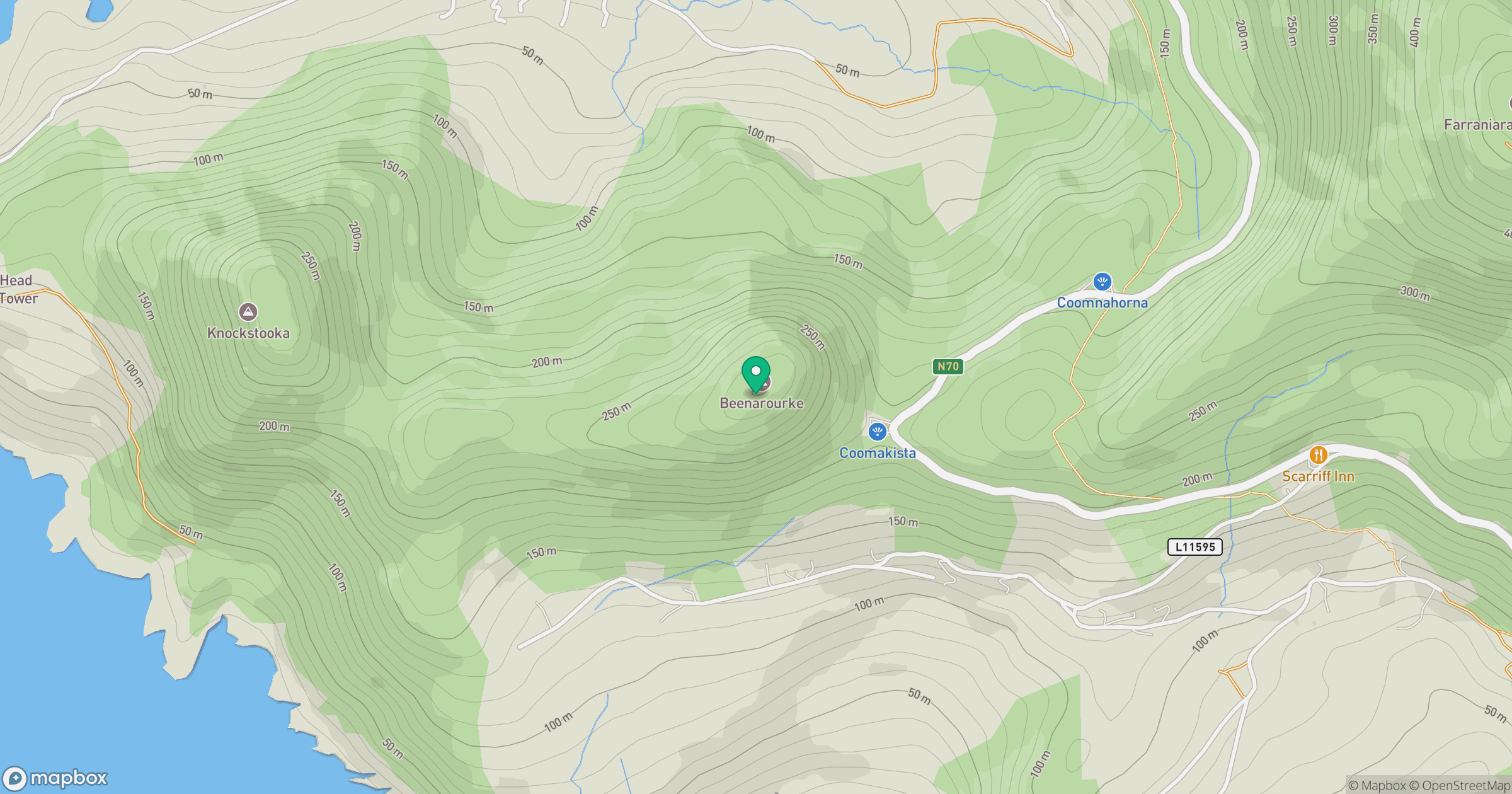
Grid reference: V501604
View on OpenStreetMapOpens a map in a new tab, centred on the hill.
Hills within 30 km
Straight-line distance, not a walking route or confirmation of access.
Sceilg Mhichil [Great Skellig]
217m
Sliabh Chathair na Gaoithe [Cahernageeha Mountain]
499m
An Rath [Eagle Hill]
155m
Scarriff Island [An Scairbh]
252m
Eagles Hill [An Bhinn Riabhach]
549m
No comments yet. Be the first.